What Are the Leading Geographical Survey Companies for Land Mapping?
Geographical surveys are an essential aspect of land development, urban planning, and environmental management. Whether you're looking to buy land, develop infrastructure, or perform environmental assessments, geographical surveys provide the data and insights needed to make informed decisions. These surveys include land mapping, which helps in understanding the topography, boundaries, and other geographical characteristics of a particular area. In this blog, we'll explore the leading geographical survey companies in UAE that specialize in land mapping and the services they offer.

What Is Land Mapping?
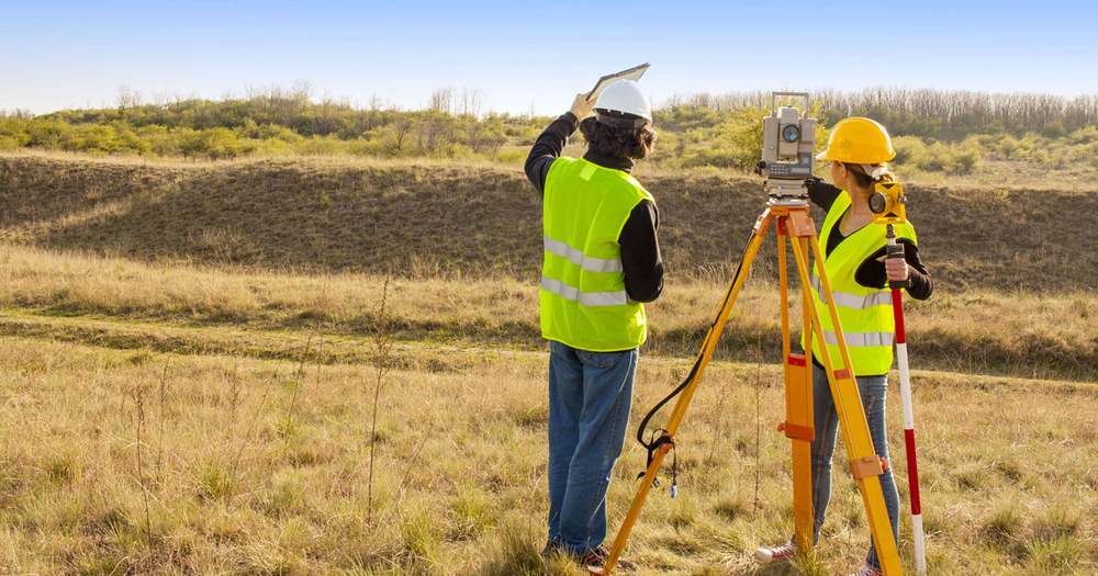
Land mapping refers to the process of creating detailed representations of a land area, highlighting its physical features such as topography, terrain, vegetation, water bodies, roads, and infrastructure. This mapping is crucial for various purposes, including construction, resource management, environmental monitoring, and urban development.
Land mapping uses different types of survey techniques and technologies, including GPS systems, remote sensing, drones, and GIS (Geographical Information Systems). The data obtained through these methods helps clients understand the landscape and plan accordingly.
Why Are Geographical Surveys Important?
Geographical surveys serve many purposes across different industries. Here are a few reasons why they are important:
- Land Ownership and Boundaries: Surveys help to define land boundaries clearly, preventing disputes and ensuring that property titles are legitimate and accurate.
- Construction Projects: Before building infrastructure or residential complexes, developers need to know the topography and the suitability of the land for construction.
- Agricultural Planning: Farmers and agricultural planners use land surveys to assess the suitability of land for cultivation, irrigation, and other farming activities.
- Environmental Protection: Survey data is also essential for environmental studies, helping governments and organizations track ecosystem changes and manage natural resources effectively.
- Disaster Management: Mapping is vital in predicting and preparing for natural disasters by identifying flood-prone or earthquake-sensitive areas.
With such a wide array of uses, it is crucial to choose a reputable geographical survey company that can provide accurate, reliable, and timely data.
Leading Geographical Survey Companies for Land Mapping
The global market for geographical surveys and mapping is extensive, with numerous companies specializing in different aspects of land surveying. Below are some of the most reputable companies in the industry.
- Fugro
Fugro is one of the leading names in the geographical survey industry, providing comprehensive land mapping and geospatial data solutions. They specialize in land and hydrographic surveys, utilizing cutting-edge technologies like drones, LiDAR (Light Detection and Ranging), and satellite imaging. Fugro’s services are widely used in construction, infrastructure development, and environmental monitoring. Their global presence and advanced survey techniques make them a top choice for companies in need of reliable land mapping.
- Landmark Surveying
Landmark Surveying is a highly regarded company that offers professional land surveying services for a variety of industries, including construction, real estate, and agriculture. They offer a range of mapping services, such as boundary surveys, topographic surveys, and site planning. The company uses the latest GPS and GIS technology to ensure the accuracy and precision of their survey data. Landmark Surveying’s detailed land mapping services are essential for clients looking to build on or develop plots of land.
- WSP Global
WSP Global is a Canadian-based company with a significant presence in land mapping and geographical survey services worldwide, including among the leading geographical survey companies in UAE. The company’s surveying division offers a variety of services, including land surveys, topographic mapping, and environmental assessments. WSP uses advanced technologies such as 3D laser scanning and GIS to deliver accurate and highly detailed geographical data. Their focus on innovation and sustainability makes them a trusted partner for large-scale development and infrastructure projects.
- AECOM
AECOM is a global engineering and infrastructure company that offers a wide range of surveying and mapping services. Their land mapping services include land boundary surveys, property surveys, and construction surveying, along with geographic information systems (GIS) data and 3D modeling. AECOM’s comprehensive geographical surveys are essential for urban planning, environmental management, and the development of public and private infrastructure.
- Geospatial World
Geospatial World is a leading provider of geospatial data and mapping services. The company specializes in land surveying and mapping, focusing on data acquisition and analysis to support planning and decision-making in land management, infrastructure development, and natural resource management. Geospatial World is known for its use of advanced remote sensing technologies, including satellite imagery and drone surveys, to produce high-quality maps and geographic data.
- Geotest
Geotest is a land surveying and geotechnical testing company that provides specialized services in land mapping and geospatial data collection. They offer services such as boundary surveys, topographic mapping, construction surveys, and more. Geotest uses a combination of traditional and modern technologies like GPS and LiDAR to deliver precise land mapping data to clients. Their expertise in geotechnical testing also enables them to offer detailed analysis for construction and engineering projects.
- Arcadis
Arcadis is a global consultancy firm that specializes in design, engineering, and land surveying services. The company’s surveying division provides a wide range of land mapping services, including boundary surveys, site surveys, and topographical mapping. Arcadis uses the latest geospatial technologies such as drones, GPS, and LiDAR to deliver detailed and accurate geographic data. Their services are used in various sectors, including urban development, infrastructure, and environmental protection.
- Surveying Solutions
Surveying Solutions is a professional land surveying company known for its reliable and accurate land mapping services. They offer topographic surveys, boundary surveys, and site planning surveys for clients in the construction, real estate, and environmental sectors. Surveying Solutions uses state-of-the-art GPS and GIS technology to ensure high precision in their survey data. Their commitment to providing thorough and accurate reports has earned them a reputation as a trusted partner in the land surveying industry.
- Bureau Veritas
Bureau Veritas, a global leader in testing, inspection, and certification services, offers comprehensive land surveying and mapping services through its Geospatial Solutions division. As one of the prominent geographical survey companies in UAE, their surveying services include boundary and topographic surveys, mapping of existing conditions, and GIS-based analysis for urban planning, construction, and environmental studies. Bureau Veritas is known for its high standards and commitment to delivering quality services to a diverse range of industries worldwide.
- Arabian Surveying
Arabian Surveying is a top-tier surveying company offering land mapping services in the Middle East. The company uses the latest technological advancements in GPS, GIS, and satellite imaging to provide precise land surveys. Arabian Surveying is known for its quick turnaround times and highly professional service. Whether it’s for urban development or environmental assessments, their team ensures that clients get accurate data and insights that support efficient land management.
Choosing the Right Geographical Survey Company
When selecting a geographical survey company for land mapping, it’s essential to consider factors such as the company’s experience, technology, and expertise in the specific type of survey you need. Look for companies with a proven track record in land surveying and mapping, especially those that offer advanced technologies like LiDAR, drones, and GIS. Additionally, ensure the company provides timely reports and is capable of working within your budget and timeline.

Conclusion
The geographical survey industry is vast, and there are many companies that offer land mapping services worldwide. The leading companies, such as Fugro, Landmark Surveying, WSP Global, AECOM, and Geospatial World, all offer highly advanced and precise surveying techniques that help businesses and individuals make informed decisions about land use and development. When choosing a surveying company, it’s crucial to consider their expertise, technology, and the specific requirements of your project.
If you’re seeking reliable and professional land surveying services in the Middle East, Arabian Surveying is here to provide top-quality geographical survey and land mapping solutions. Visit arabianse.com for more information.
Contact
For more information or to schedule a consultation, feel free to contact us at +971-56-1466788. Our team is ready to assist you with all your land surveying and geographical mapping needs.
What's Your Reaction?